In Alice’s Looking Glass world, she set off walking straight up the path towards the top of the hill until the twists and turns (‘more like a corkscrew than a path’) led her back to the house each time. So, every time I’m about to expound a theory of where arx Cynuit could have been, if not at Countisbury, something else crops up. This time it’s an alternative which seemed to gather a modicum of credence, not least as being the idea of a writer of highly popular children’s books (NB some of the facts in this linked report are definitely wrong not wholly accurate).
The site is on Castle Hill, Beaford, near(ish) to the confluence of the rivers Taw and Torridge, and much closer to the Devon-Cornwall border. On the face of it, there seems no evidence to point to that location, rather than to many another near the coast of Devon and and Somerset.

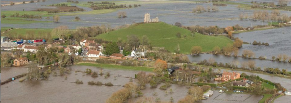
Red square marks the distance of Castle Hill from the coast and, inset, its position above the river Torridge meander.
In this case, the Vikings must have chosen the longest crossing of the Bristol Channel from Dyfed in west Wales, though they could have based themselves on Lundy and launched an attack from there.

Nothing much remains of the original fortification except a few sections of rampart
They might have rowed up the Torridge if it was navigable but, contrary to what was claimed, there is nothing particularly well protected about this site, as Asser described it (‘ille locus situ terrarum tutissimus est ab omni parte, nisi ab orientali, sicut nos ipsi vidimus’).
The site is just north of a meander in the river and appears (at least nowadays) to be relatively accessible from all directions. The banks of the river are quite steep (and probably thickly wooded at that time): did the Vikings row all the way round the meander, looking for a place to disembark? It’s the only way they would have arrived at the eastern side. If they didn’t row up the river, but disembarked close to the estuary, the locus would have been even less ‘tutus’.
The nearby village of Kingscott does not, as apparently claimed, furnish a similarity with the name Cynuit. All that has been ‘discovered’ is that an ancient hillfort might well have been used as a fortified camp by the Saxons at some point (just as Alfred set up his fortress on Athelney using an Iron or Bronze Age camp).
Is there any evidence that Asser himself might have visited a site so close to the Cornish border, where the Britons had only relatively recently been subdued? It might account for the presence of a border contingent of thegns, but other than that the contemporary sources suggest other places for arx Cynuit that seem more likely – including Countisbury.
The thing about theories is that if they seem possible, they tend to become probable; and if probable, they become fact:
“Lundy Island may have come under attack during the Viking raids on Devon, Bristol and Wales that took place in the eighth and ninth centuries. The Viking chieftain, Hubba, led a raid on North Devon from Wales in 878 and was killed near Appledore on the coast of the mainland. An area known as the Giants’ Graves on Lundy is rumoured to be his resting place.”
The ‘fact’ is that it isn’t even certain that (H)Ubba was the chieftain who led the raid, and certainly not that he ‘was killed near Appledore’. And a rumour is just a rumour.
And so also, while we’re in the area, another suggested location: ‘Kenwith Castle, a quondam ancient fortalice in Abbotsham [Northam?] parish, Devon; on the coast, 2 miles W of Bideford. It was the place where Odun, Earl of Devon, in 878, Vanquished and slew the Danish invader Hubba but is now represented by only a traditionary spot on a hill called Henny Castle.’
The name Kenwith is a good fit but little sign of a substantial settlement or hillfort. Both Kenwith and Beaford are in the same hundred – Merton – so vie with each other for the honour. The association with the Viking Ubba and the Devon ealdorman Odda shows contamination with later historical reconstructions, since there is no contemporary source which names either combatant. To my knowledge.
A verdict on Kenwith: “There is probably a great deal of fanciful[ly] writing connecting a C9 historical record with some slight earthworks on a hill.”
And, apart from any of that, as any fule kno, Countisbury is the place where ealdorman Odda slew Ubba the Viking and his 800, or was it 1,200, men.
Heigh ho. No reason why I shouldn’t add my two penn’orth. But before that – another turn in the path …

It would be interesting to read your thoughts on Gaimar.
When dealing with early medieval battlefields in the absence of conclusive archaeological evidence one can only talk in terms of the most probable site based on the available evidence.
It’s therefore OK to be unconvinced about a given site – in fact it’s the only rational position. Even I am unconvinced (that is to say not 100% certain about Castle Hill). However my research does suggest that Castle Hill is the most probable site based on the available evidence.
As I explain in the paper the place name evidence may not be helpful if the name does not survive and in any case it’s not conclusive for Countisbury. The topographical evidence is more helpful and Castle Hill is by far the best fit. In addition there is circumstantial evidence relating to the ownership of surrounding estates and the way in which the Vikings waged war in 878.
Of course if anyone wants to question the evidence I offer on any specific grounds – or even better offer new and stronger evidence in support of another site I would be delighted to hear from them. After all it is only through such discussions that knowledge advances.
Ultimately the final test could be archaeology but even this can be inconclusive for an early medieval battlefield – just look at Hastings!
LikeLike
Still quite a bit to think about here. Nick, I think it was probably clear that I was unconvinced by your identification. I still am, but there are some interesting features about the Geffrei Gaimar reference, and others. I’m tempted to return because this – for one rare occasion – would take me to my own specialism as a teacher: Old French. So I might attempt a further blog on it next. Please do comment on it.
LikeLike
Gaimar’s Bois de Pene means Penwood – as Short accurately translates it. The name is based on the Bythonic word penn meaning a promontory. This shows that Gaimar and Asser were describing the same place – even though Gaimar never read Asser. It was a place secure except from one direction. According to Gaimar, Ubbe was killed in this wood (and since Asser reported that he was killed in front of the fort this meant that the wood was east of the fort). Gaimar claims there was a barrow in the wood.
The land east of Wind Hill was not wooded in 1086 and probably not wooded in 878. Nor is there any trace of a barrow (ironic given that burial mounds are common in the area).
Place name evidence shows that there was (indeed there still is) a wood to the east of Castle Hill. There is also an artificial mound that has identified through geophysics as a potential barrow.
LikeLike
You’ve done your homework …I’ve been glancing throught Risdon and Camden again, though in the end the only ‘reliable’ piece of topographical evidence is Asser’s contemporary account; and that leaves a lot to be guessed at. Geoffrey Gaimar in the 12th c. had access to a source we don’t have, but either he or it was a bit confused as to where the action took place. ‘El bois de Pene’? Penselwood? He doesn’t mention anything like Cynuit. It looks as if Matthew Parker’s 1574 edition of Asser’s Life of Alfred provided the later antiquarians, from Camden(?) onwards, with what they needed to set off in pursuit of arx Cynuit.
LikeLike
Thank you for drawing my attention to the Latin first edition of Camden’s Britannia (1586). In this Camden appears to be pondering whether arx Cynuit is at Chulmleigh. He then states that the fort was near the banks of Taw (presumably in this area)..
By the 1607 edition Camden seems to have given up on Chulmleigh and although he uses almost exactly the same Latin text he moves the discussion of Cynuit to the Taw between Raleigh (near Barnstaple and the estuary – stating that although Torridge does not meet the fort it is near the riverbanks (of the Taw) and implying that it was in the region of the lower Taw.
So what is going on?
I don’t think Camden ever knew where the fort was – hence his vagueness. He was interested because he had studied the now destroyed mss of Asser and I suspect written to local experts. I suspect they told him in rather sceptical terms about Stone Barton Castle near Chulmleigh and this is what he is referring to in 1586.
The Castle is mentioned by Westcote in 1630 as a rumoured site for Cynuit although Westcote was also sceptical.
By 1607 Camden clearly thought better and his revised text is clearly a catch-all – simply reflecting his feeling that the fort was near the Taw although presumably not Stone Barton Castle after all.
So were Camden and Westcote right to be sceptical? Yes, I think they were – I haven’t been to the castle (although I intend to visit) but I did consider it during my research and it is not a terribly convincing site.
1 The topography is wrong – it is not hard to get to except from the east.
2 The enclosure is less than 40 metres square and far too small to contain an army large enough to kill 840 Vikings.
3 The enclosure appears to be later medieval and stone-built (whilst arx Cynuit was iron age and had walls of earth).
All this brings me to Kenwith near Appledore. This entire myth was based on Risdon’s attempt to find arx Cynuit based on Camden’s 1607 thoughts. Taking his cue from the lower Taw (at this time thought to include what we now call the Taw/Torridge estuary) Risdon identified the sites we now call Kenwith and Hubbastone solely on the basis of some very dodgy etymology. In fact Kenwith is a natural knoll and Hubbastone was probably the remains of a quarry spoil heap. Although much cherished by local people and revived in the 1800’s the myth is sadly nothing more than that.
I hope this information is useful – in my original research I used the 1607 edition of Camden and it was interesting to compare this with the 1586 edition.
Regards
Nick Arnold
LikeLiked by 1 person
Hello, Nick! Thanks for your comments. The problem with amateurs like me is that, from a standing start (nil knowledge) you work like fury on a particular subject, become an overnight ‘expert’ on it and when the subject comes up a year later you’ve forgotten what you were talking about.
Another direction I had been thinking of moving into was all the various sources (many late) which down the centuries persistently linked arx Cynuit with that bit of the Devon coast, and around Appledore, like the 18th/19th c. poem by John Fitchett (King Alfred). My ideas rather petered out and having satisfied myself (at least) that Countisbury was not the place, I failed to come up with somewhere better.
I agree with a lot of what you say – no reason at all to suppose the name Cynuit survives in any form whatsoever as a modern placename.
LikeLike
I was interested to read your thoughts on the Battle of Cynuit. It might help you to read the paper I wrote for the Devonshire Association and perhaps visit the proposed site at Castle Hill to see how closely the site matches the fort and topography described by Asser and Gaimar.
In the meantime a few points to make:
1 There is no objection to the Vikings sailing from Dyfed to north Devon – Viking ships were quite capable of long sea voyages in the ninth century. Lundy may have been used as a staging post but there is no evidence for this.
2 I would not suggest that the Vikings sailed up the River Torridge – and certainly not as far as Castle Hill (the river is not navigable this far). The truth is we don’t know where they landed but the ASC and Asser both state that the Vikings fled to their ships, and by implication that the ships were not at arx Cynuit.
3 The place name Kingscott may or may not be related to the personal name Cynwyd – and although reported in the media, it’s not a point I rely on the paper. The original arx Cynuit was an informal name (not a place where people lived) and so not guaranteed to survive.
4 Asser may have visited Castle Hill when he was based at Exeter in the 880s. Castle Hill is on the way to Hartland which was an important saint’s shrine and a royal estate. There is no obvious reason why Asser would have visited Countisbury.
5 One way to look for an early medieval battlefield is to look for royal interest in securing the area – burhs, land grants and the like after 878. One can show this for Castle Hill but not for Countisbury.
Good luck with your research!
Regards
Nick Arnold.
LikeLiked by 1 person